
Real-time location tracking has become an essential feature in modern mobile applications. Whether you're building a ride-hailing platform, food delivery app, logistics system, employee tracking solution, or fleet management software, Google Maps combined with Flutter provides a powerful foundation for creating scalable location-based applications.
In this guide, we'll explore the technologies, architecture, and best practices for building a real-time Google Maps based Flutter application.
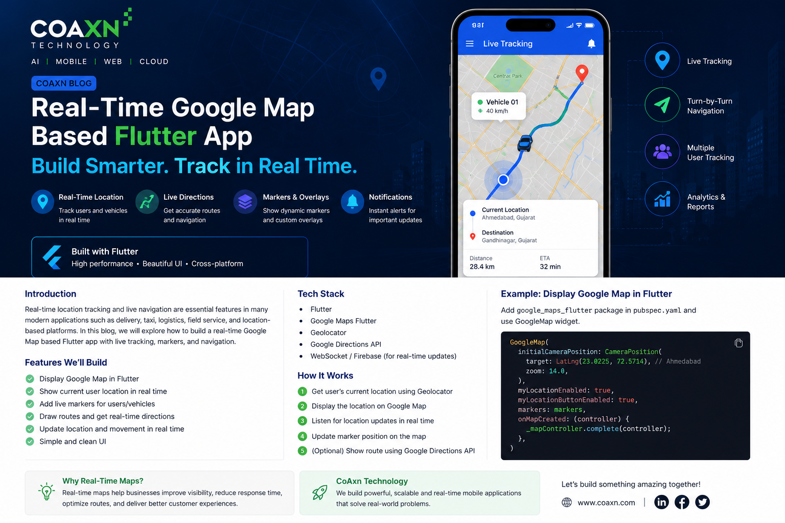
Why Choose Flutter for Real-Time Map Applications?
Flutter enables developers to build high-performance Android and iOS applications from a single codebase. Combined with Google Maps, it offers smooth animations, customizable UI, and excellent performance.
- Single codebase for Android & iOS
- Beautiful native-like UI
- Fast development cycle
- Excellent performance
- Easy integration with Google APIs
Common Use Cases
- Taxi Booking Apps
- Food Delivery Tracking
- Courier & Logistics
- Fleet Management
- Employee Location Tracking
- Emergency Response Systems
- Travel & Tourism Apps
- Asset Tracking
Technology Stack
- Flutter
- Google Maps Flutter SDK
- Geolocator Package
- Google Directions API
- Google Places API
- Firebase Cloud Messaging
- Firebase Firestore / Realtime Database
- WebSocket / Socket.IO
- Node.js Backend
Key Features
1. Live User Location
Display the user's current GPS position using the Geolocator package. The location updates automatically as the user moves.
2. Live Vehicle Tracking
Receive driver or vehicle coordinates through WebSocket or Firebase and update markers on Google Maps instantly.
3. Route Navigation
Use the Google Directions API to draw optimized routes between source and destination.
4. ETA Calculation
Estimate travel time and remaining distance dynamically using Google Maps services.
5. Custom Markers
Create branded markers for drivers, customers, warehouses, or delivery locations.
6. Geofencing
Trigger events when users enter or leave predefined geographical boundaries.
7. Push Notifications
Notify users about trip updates, deliveries, or arrivals using Firebase Cloud Messaging.
Application Workflow
- User opens the Flutter application.
- GPS permission is requested.
- Current location is obtained.
- Google Map loads with current position.
- Backend receives location updates.
- Other users receive updates through WebSocket or Firebase.
- Map markers refresh in real time.
- Route and ETA are recalculated automatically.
Recommended Flutter Packages
- google_maps_flutter
- geolocator
- flutter_polyline_points
- google_place
- permission_handler
- firebase_core
- firebase_messaging
- cloud_firestore
- socket_io_client
Performance Tips
- Update location every 3–5 seconds instead of every second.
- Reduce unnecessary map rebuilds.
- Use marker clustering for thousands of markers.
- Cache frequently used map assets.
- Optimize API requests.
- Throttle GPS updates to save battery.
Security Best Practices
- Secure Google API Keys.
- Enable API restrictions.
- Encrypt communication using HTTPS.
- Authenticate users before sharing location.
- Validate coordinates on the backend.
- Store sensitive data securely.
How CoAxn Technology Can Help
At CoAxn Technology, we build scalable Flutter applications with real-time Google Maps integration for logistics, healthcare, transportation, field service, delivery management, and enterprise solutions.
Our expertise includes Flutter, Firebase, Google Maps APIs, WebSockets, AI integration, OCR solutions, cloud infrastructure, and custom backend development.
Conclusion
Real-time Google Maps applications have become a critical component of modern digital businesses. By combining Flutter with Google Maps, Firebase, and WebSockets, organizations can deliver responsive, location-aware applications that improve operational efficiency and customer satisfaction.
If you're planning to develop a real-time tracking solution, the right architecture and technology stack can ensure your application remains secure, scalable, and ready for future growth.